10-Day Weather Outlook for Northeast Scotland
| Synopsis 3-day Outlook Extended Outlook Disclaimer |
|
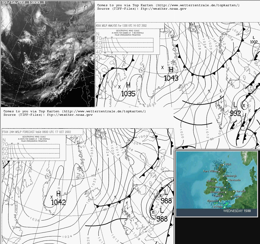
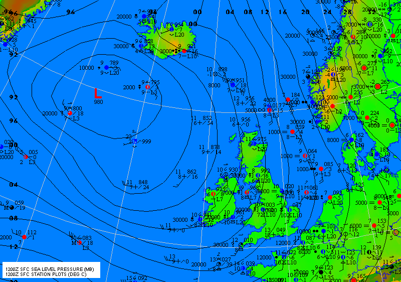
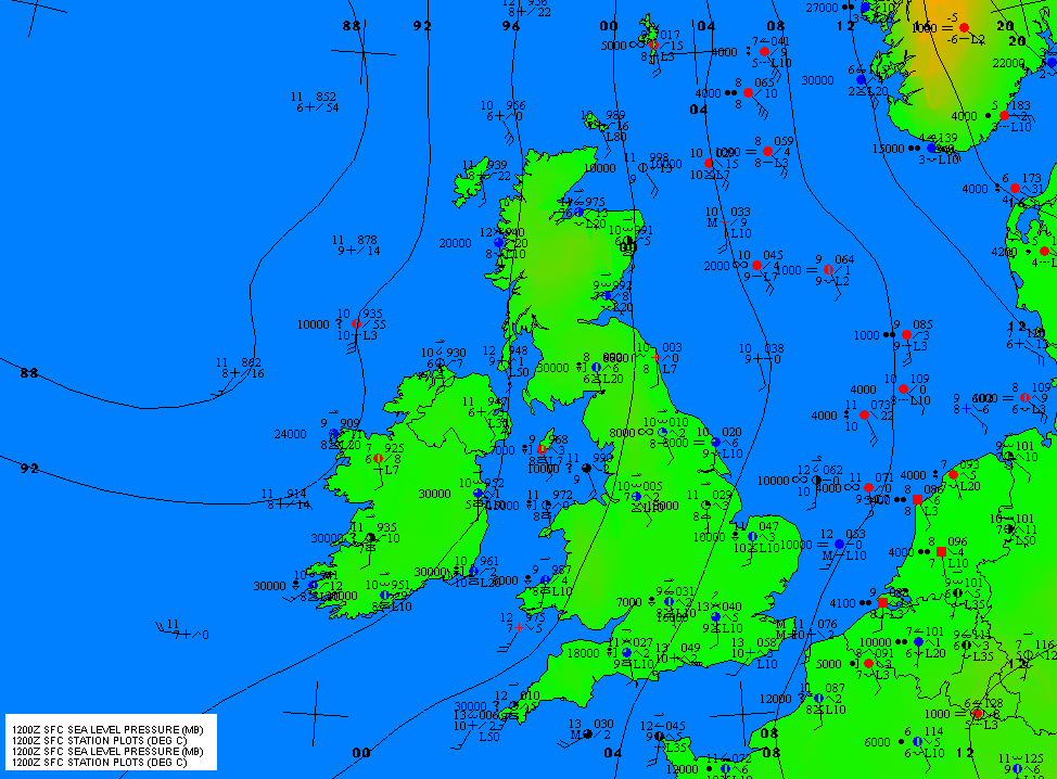
Move mouse over current pressure chart on right for forecast chart. ASXX: 1200 UTC FSXX: 0600 UTC UK & near Continent plotted data Mean Sea
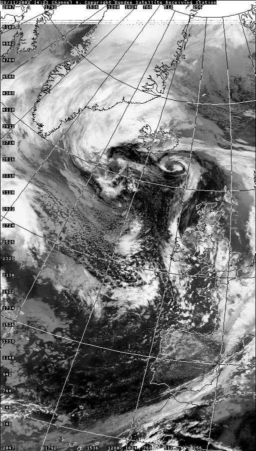
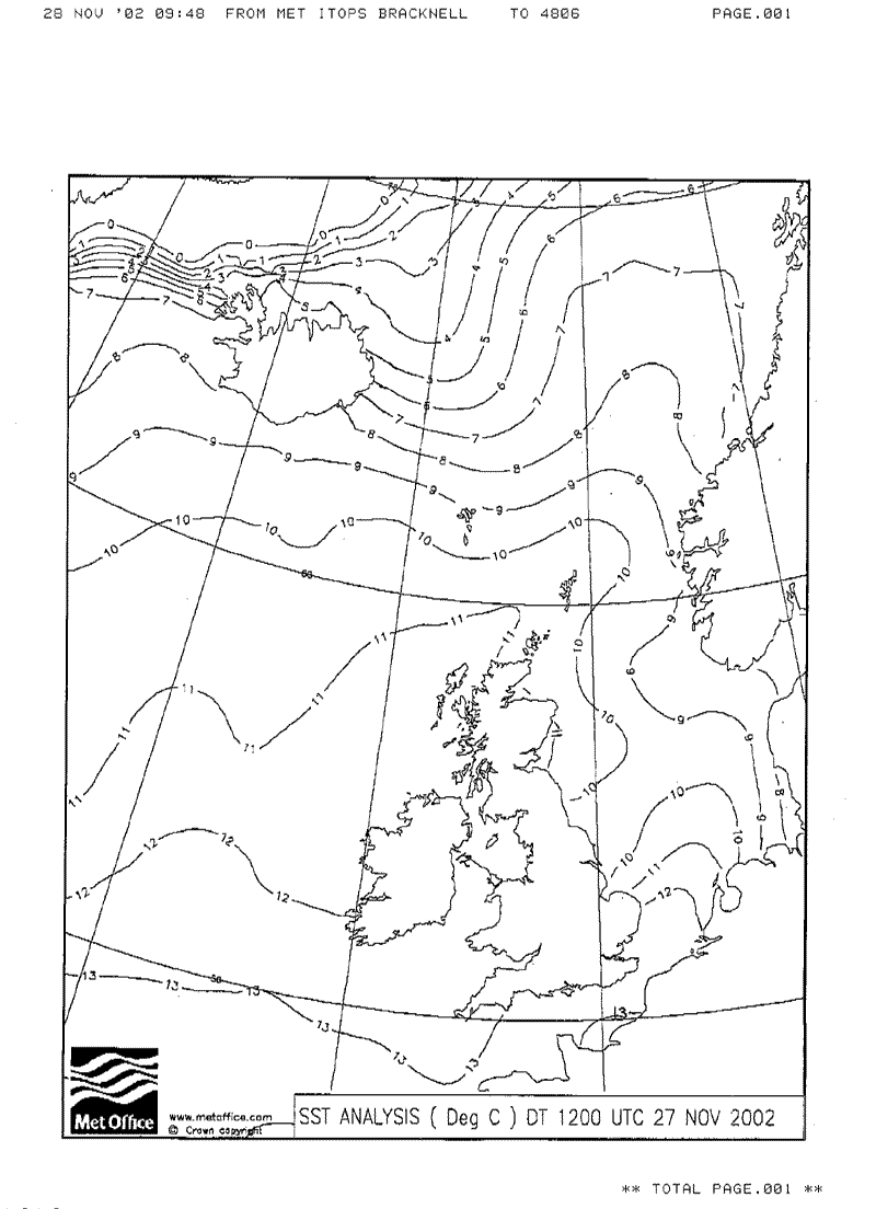
Temperature Chart 1423 UTC Satellite
pictures obtained from Climate change? The Climate of Orkney NOTE To view the above file you will, if this is not already installed on your computer, have to download the freeware program Adobe Acrobat Reader. To obtain this click on icon below -
|
General Situation at 06:00 UTC
28/11/02
with Inference With high pressure persisting to the northeast and an Icelandic low driving a frontal system east into Scotland during Saturday the SE’ly airflow is expected to strengthen – especially later on Sunday as a secondary low runs rapidly north to the west of Scotland. The computer models continue to show a very unsettled prospect for next week with a deep depression never far away from the north of the British Isles - producing an often strong, generally SW to NW’ly, airflow over Scotland. |
|
3-day Outlook for Northeast Scotland Mild with temperatures, rising to 9° to 11° Celsius, falling
to 7° or 8° Celsius overnight – possibly a chillier 4°
Celsius for mainland Orkney and Caithness where skies clear. FRIDAY 29th: Becoming mostly cloudy in the north of
Shetland overnight with patchy rain or showers – these slowly spreading
south to the remainder of Shetland during the day. Winds in Shetland will
be a F5 SE’ly. Orkney and Caithness will be brighter and drier with
scattered showers and F3-5 S to SE’ly winds – the showers
possibly becoming more frequent over the North Isles during the evening. SATURDAY 30th: Generally cloudy with scattered showers.
Later in the afternoon and during the evening F4-5 SE’ly winds are
expected to increase to become F6-7 by late evening as rain moves north
through the area to reach much of Shetland by midnight. |
||
Extended Outlook for Northeast Scotland Mild at first with temperatures in the daily range 8° to 10° Celsius, turning noticeably cooler by midweek with temperatures in the range 5° to 8° Celsius. SUNDAY 1st: Becoming mostly dry by morning with F5 SE’ly
winds. After a bright start cloud is likely to thicken from the south
during the afternoon as SE’ly winds back E'ly and increase F7 to
gale F8. Rain spreading north during the evening but probably not reaching
until late. TUESDAY 3rd – SUNDAY 8th: Some improvement possible
for Tuesday with light N'ly winds and scattered showers. remainder of
week probably remaining unsettled and perhaps turning cooler after midweek
with winds, increasing strong to gale force at times, mainly from between
SW and NW in direction. |
||
|
A text version of the 10-day outlook for Northeast Scotland is also
available by e-mail on a weekly basis - usually at the weekend. Or e-mail short text messages to wheelerdave@sms.genie.co.uk and I'll receive them via my mobile phone.
|
|
North-East Scotland is available from Online Weather Interface |
||
| Also available are daily forecasts for many towns and cities in the British Isles including:- | ||
| Lerwick Kirkwall Aberdeen Inverness Aviemore Dundee Glasgow Edinburgh | ||
