![]()
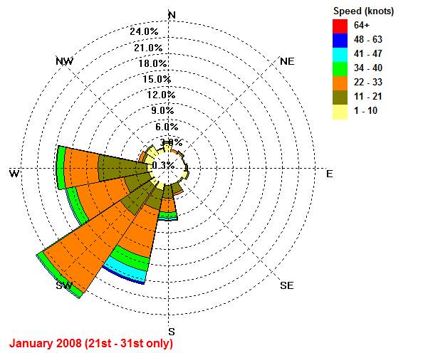
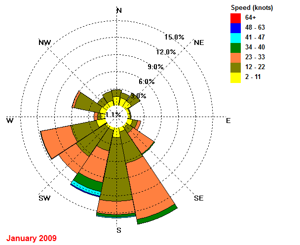
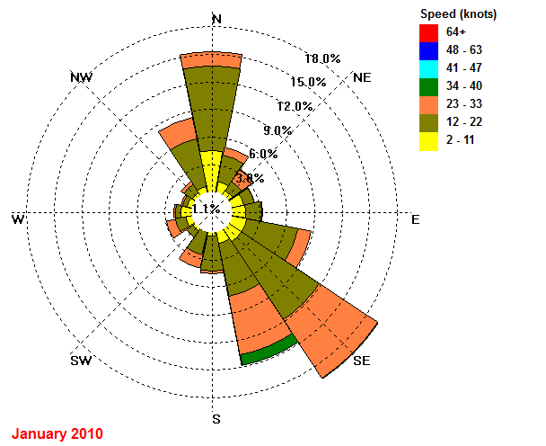
| FAIR ISLE CLIMATE Analysis of Wind Direction and Wind Speed at Fair Isle using Wind Rose diagrams |
| 2007 | 2008 | 2009 | 2010 | |
| January | 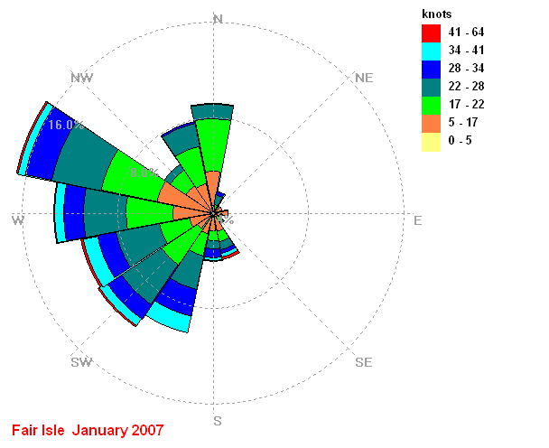 |
 |
 |
 |
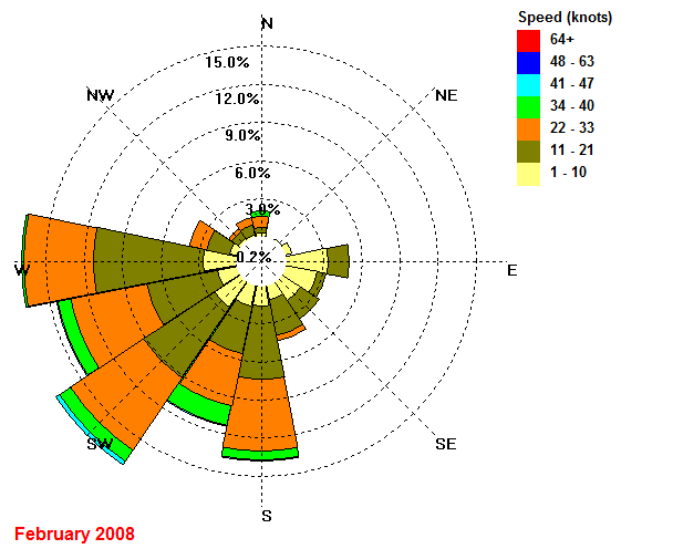
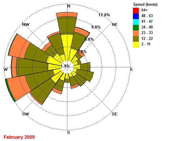
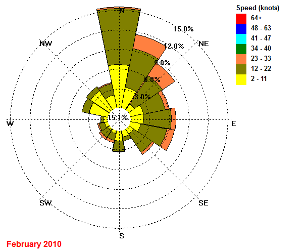
| February | 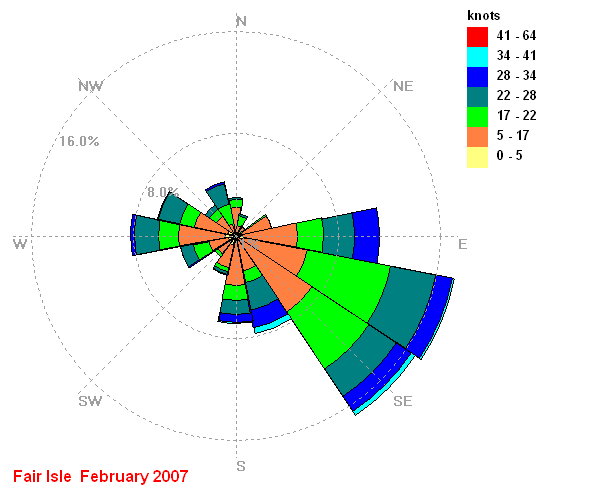 |
 |
 |
 |
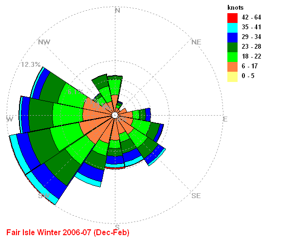
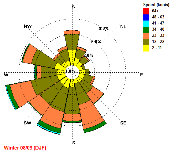
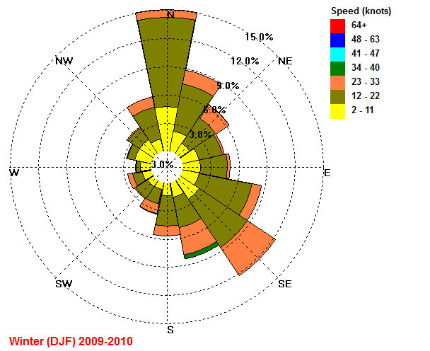
| Winter DJF |
 |
_2007-08.gif) |
 |
 |
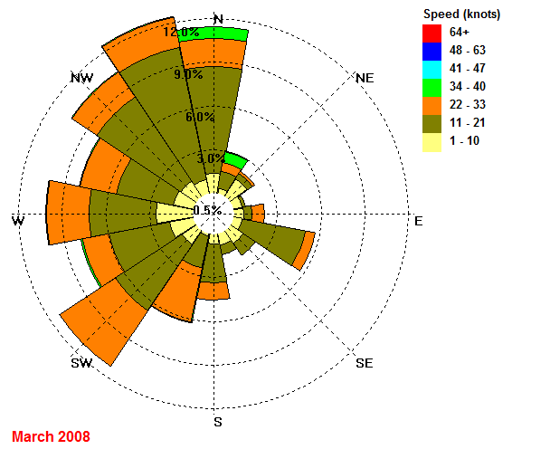
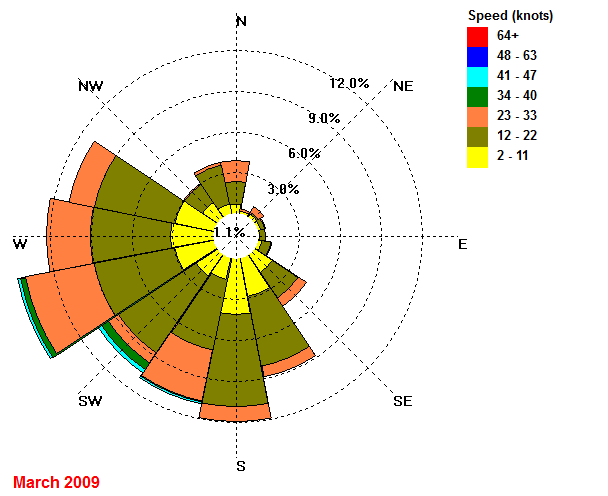
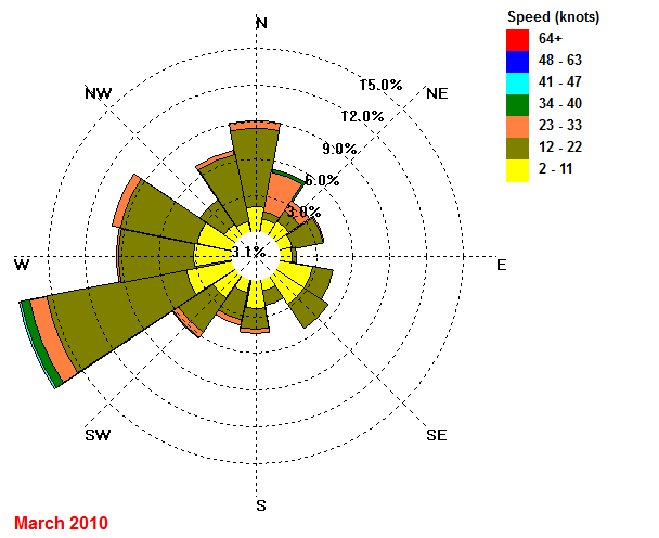
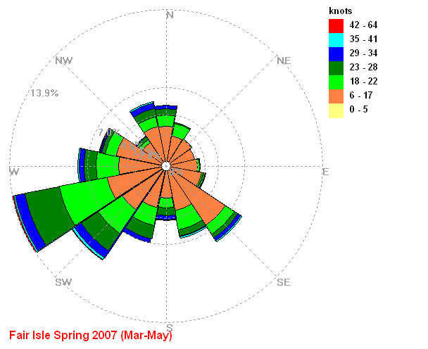
| March | 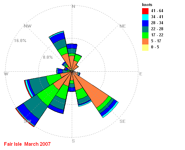 |
 |
 |
 |
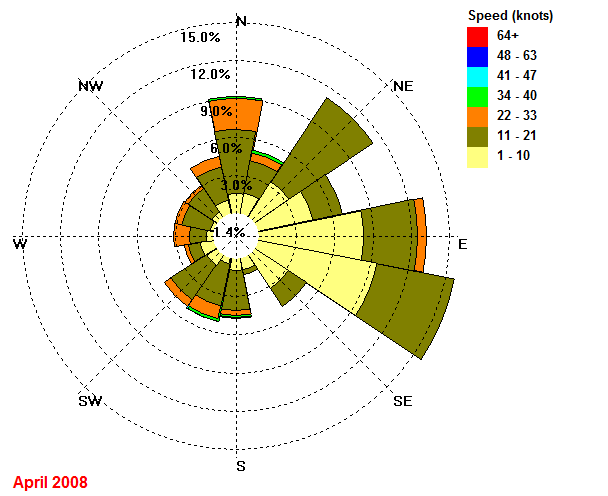
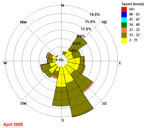
| April | 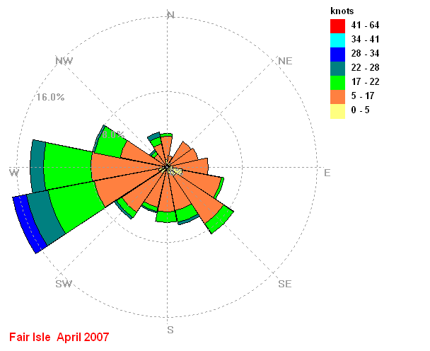 |
 |
 |
|
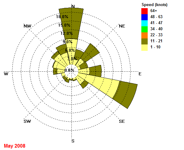
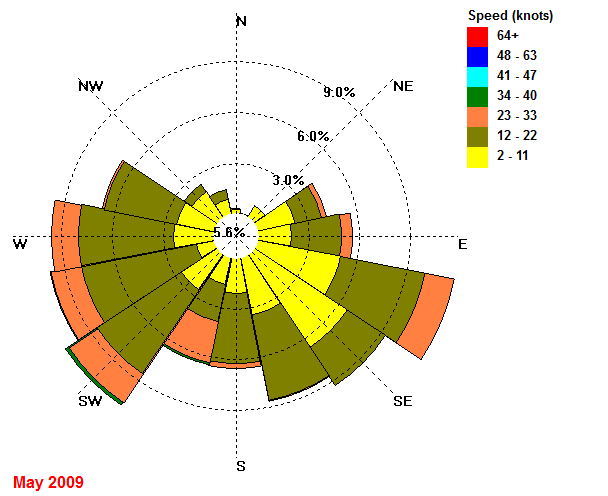
| May | 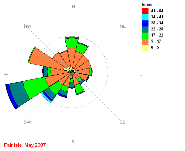 |
 |
 |
|
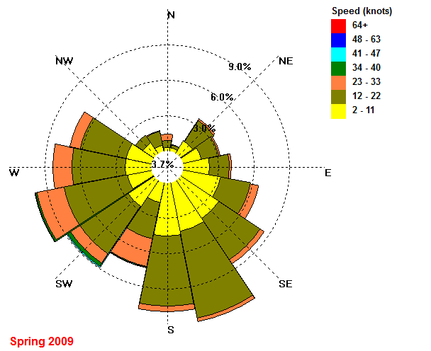
| Spring MAM |
 |
_2008.gif) |
 |
|
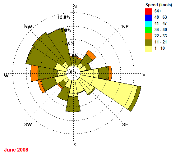
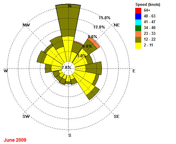
| June | 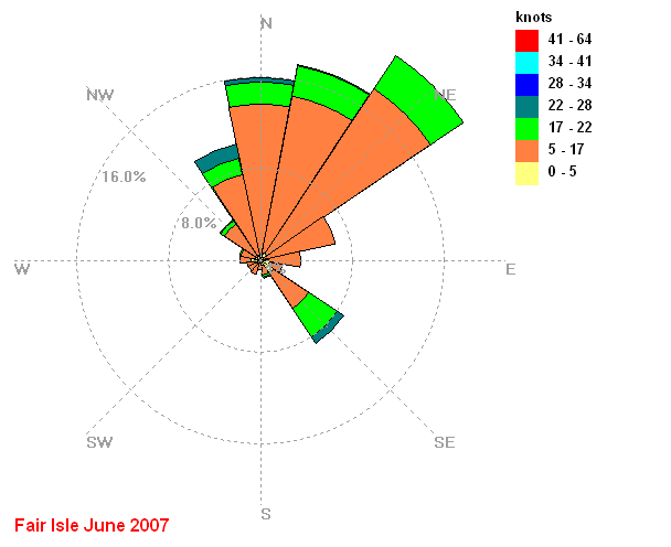 |
 |
 |
|
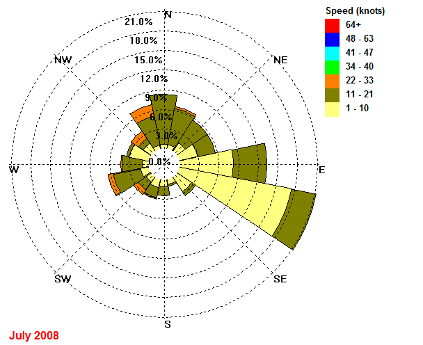
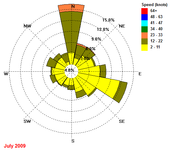
| July | 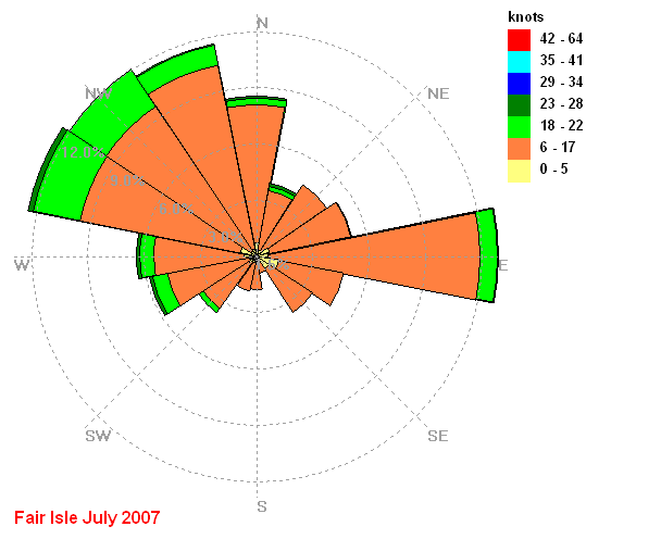 |
 |
 |
|
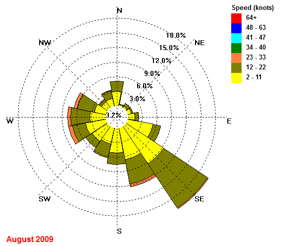
| August | 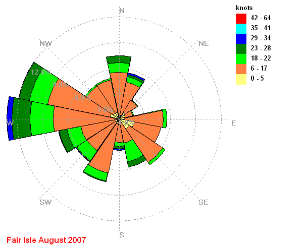 |
 |
 |
|
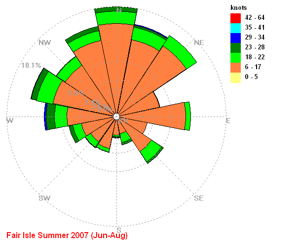
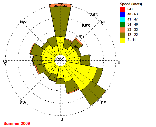
| Summer JJA |
 |
_2008.gif) |
 |
|
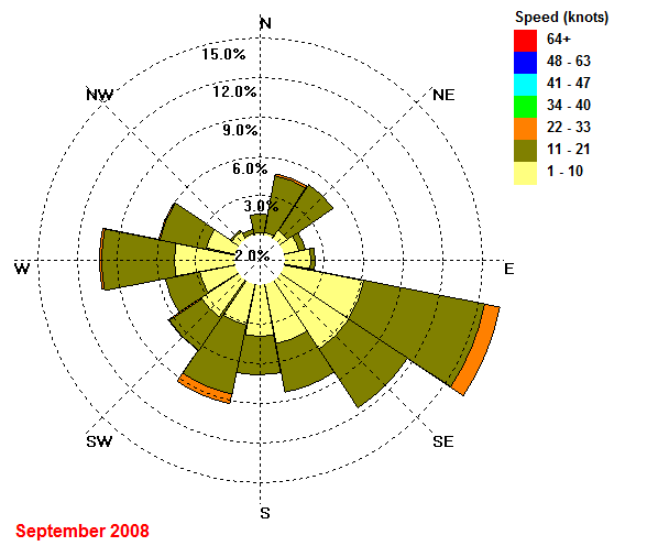
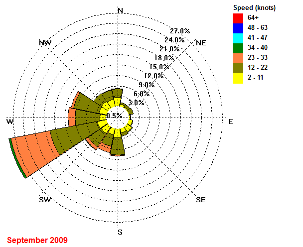
| September | 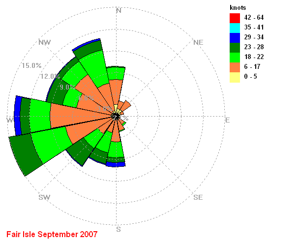 |
 |
 |
|
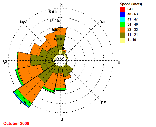
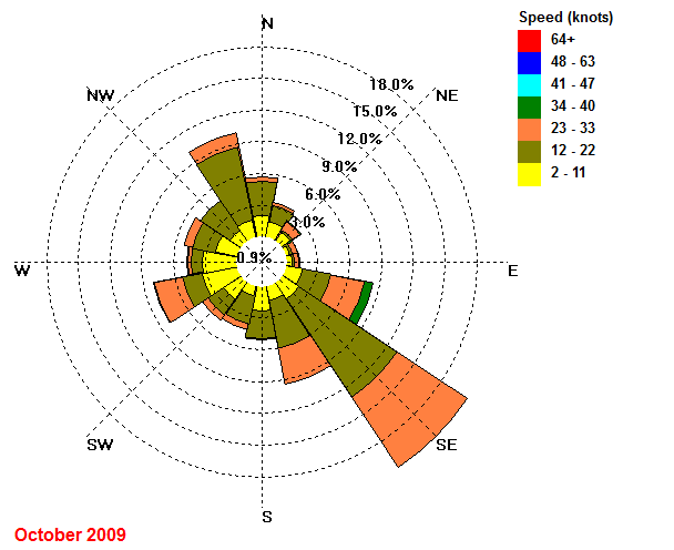
| October | 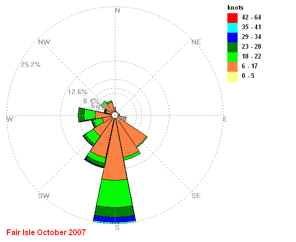 |
 |
 |
|
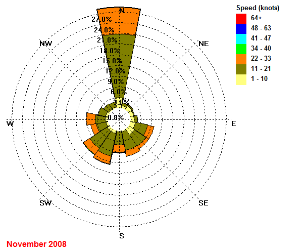
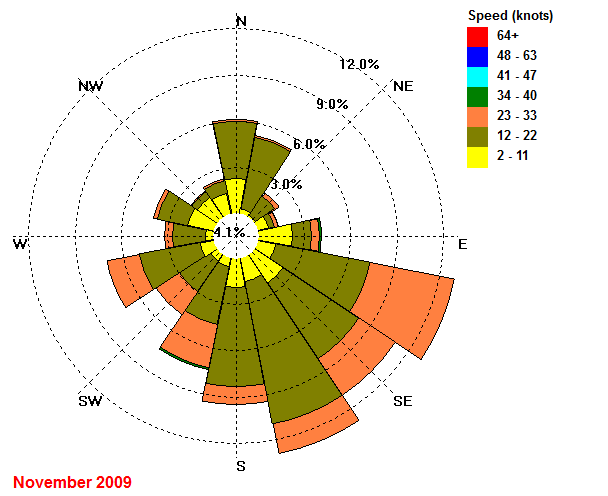
| November | 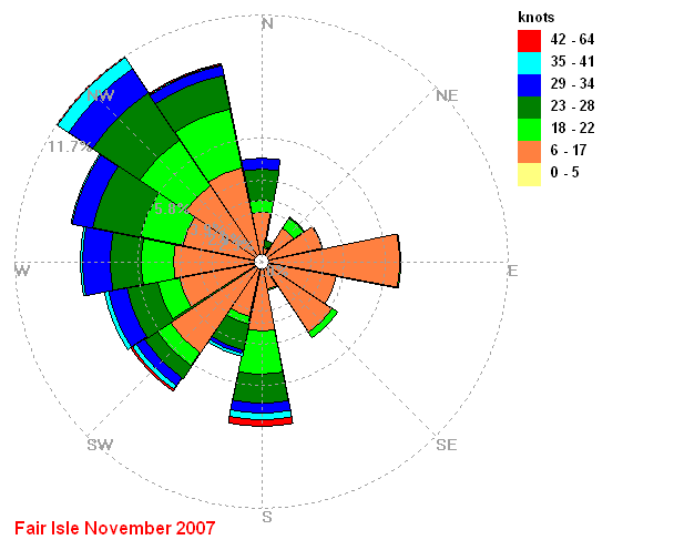 |
 |
 |
|
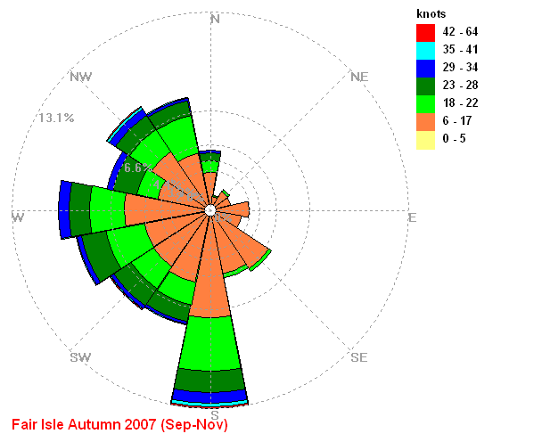
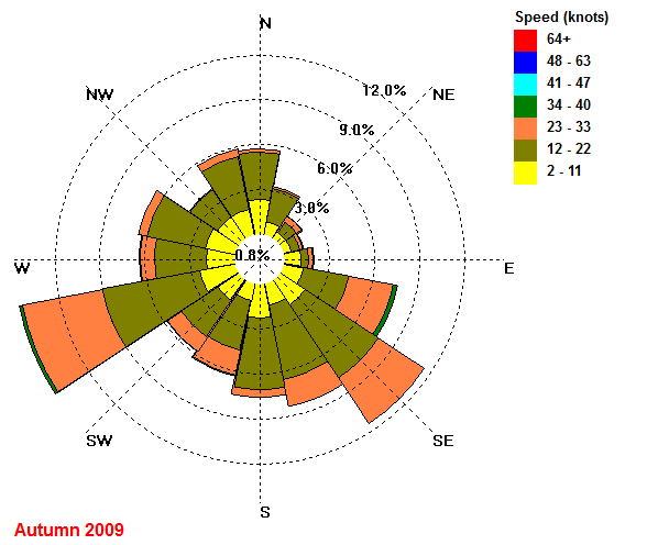
| Autumn SON |
 |
_2008.gif) |
 |
|
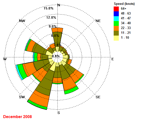
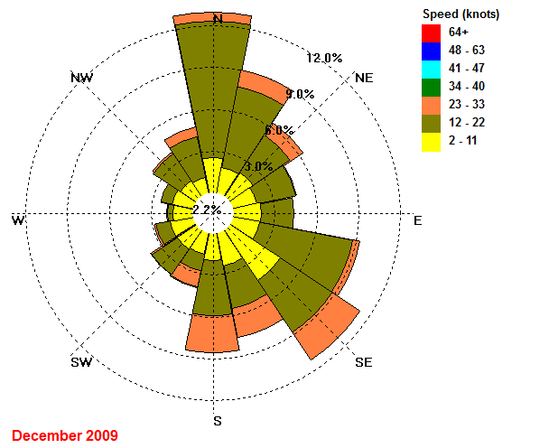
| December | 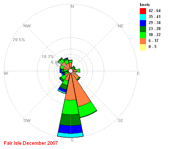 |
 |
 |
|
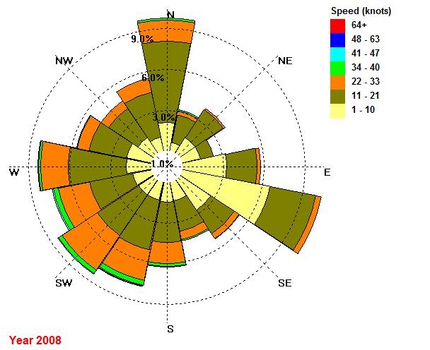
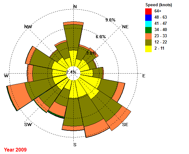
| Year | 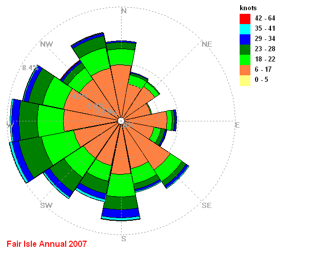 |
 |
 |
These charts are plotted using data from my Davis VantagePro2 and WindRose Pro from Enviroware
It is an involved process, but for anyone interested the steps are-
1 Export required data from WeatherLink as a text file
2 Import text file into Excel
3 Write a lookup (VLookup) table to convert compass points (NNW etc) to degrees (avoid decimal points)
(Right click this link and select 'save as' to download the Excel file (,xls) containing the VLookup array)
4 End up with two cols of data - direction and speed
5 Export this data as a comma delimited file (.csv)
6 Import the .csv file into WindRose and
7 Save chart (.bmp only option)
8 I then converted .bmp file to .gif file for use on the web.